If you love adventure, spectacular mountain views, and authentic cultural encounters, then hiking to Pha Luong Peak in Moc Chau should be on your bucket list. Known as the “Roof of Moc Chau,” this trekking route offers a blend of untouched landscapes, challenging trails, and breathtaking scenery along the Vietnam–Laos border. In this guide, we’ll walk through everything you need to know about the hike—how to get there, when to go, what to expect, and how to prepare—so you can conquer one of northern Vietnam’s most rewarding treks.

Pha Luong Peak, also called “the Great Pha Luong Mountain,” stands at about 2,000 meters above sea level in Son La Province, near the Moc Chau Plateau. This mountain marks part of the natural border between Vietnam and Laos, making it not only a hiking challenge but also a cultural journey across regions inhabited by Thai and Hmong ethnic groups.
Unlike the more crowded hiking destinations in northern Vietnam such as Fansipan or Pu Luong, Pha Luong remains less commercialized, perfect for travelers seeking authentic eco-tourism experiences.
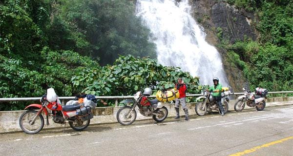
Pha Luong lies in Moc Chau District, Son La Province, roughly 200 km from Hanoi. The peak is located in Muong Sang Commune, close to the Laos border. Travelers often combine a Moc Chau tour with a visit to the Bach Long Glass Bridge, tea hills, and Dai Yem Waterfall for a full northern Vietnam adventure.
Best Time to Hike to Pha Luong Peak
The best time to hike Pha Luong Peak is between November and April, when the weather is dry, skies are clear, and temperatures are cooler. This season also coincides with blooming peach and plum blossoms in Moc Chau, adding extra beauty to your journey.
Avoid hiking during the rainy months of May to September, when muddy trails and mist can make the climb dangerous.
How to Get to Pha Luong Peak
-
From Hanoi to Moc Chau: Take a bus, limousine, or private car. The journey usually takes 4–5 hours via National Highway 6.
-
From Moc Chau town to Pha Luong Base: Continue by motorbike or car for about 20 km to Muong Sang Commune. The road is steep and winding, so experienced drivers are recommended.
-
Local support: Visitors must check in with border guards before hiking because the trail leads close to Laos. Hiring a local guide is essential for safety and navigation.
Hiking Trail to Pha Luong Peak
The trail from the border post to the summit takes 3–4 hours, depending on your pace.
-
Trail difficulty: Moderate to challenging. The path includes dirt tracks, steep climbs, and dense forests.
-
Landscape highlights: Bamboo forests, rocky cliffs, panoramic views over Laos and Vietnam, and traditional stilt houses of Hmong and Thai villagers.
-
Summit views: At the top, hikers are rewarded with a flat rocky platform overlooking an endless mountain range—perfect for photography and relaxation.

What to Pack for the Hike
-
Essential gear: Trekking shoes, light backpack, raincoat, and water bottles.
-
Clothing: Layered outfits (temperatures drop sharply in the evening), hat, gloves, and sunscreen.
-
Food and supplies: Bring snacks, fruits, and energy bars since there are no stalls on the trail.
-
Permits: Don’t forget ID and permit requirements at the border guard station.
Why Hike to Pha Luong Peak?
-
Adventure: Unlike tourist-heavy spots, this trail gives you a raw, unfiltered trekking experience.
-
Scenic beauty: Endless ranges, misty valleys, and golden sunsets at the summit.
-
Cultural connection: Interactions with Hmong and Thai villagers enrich the journey.
-
Eco-tourism value: Low-impact travel that respects the natural environment and supports local communities.
Eco-tourism and Sustainability at Pha Luong
Pha Luong is part of Vietnam’s effort to promote eco-tourism in northern highlands. Travelers are encouraged to practice responsible tourism by:
-
Staying at local homestays.
-
Avoiding littering and plastic use.
-
Supporting community-based tourism projects.
-
Respecting cultural traditions.
FAQs about Hiking Pha Luong Peak
Is Pha Luong Peak safe to hike?
Yes, but it requires preparation. Trails are steep and remote, so hiring a guide and checking in with border guards is mandatory.
How long does it take to hike Pha Luong Peak?
The trek usually takes 3–4 hours one way. A round trip plus time at the summit can take a full day.
Do I need a permit to hike Pha Luong?
Yes, hikers must register with the border guard station in Muong Sang Commune before starting.
What else can I do in Moc Chau besides hiking?
You can explore tea hills, visit Dai Yem Waterfall, stroll through pine forests in Ang Village, and walk across the Bach Long Glass Bridge.
Can beginners hike Pha Luong Peak?
While beginners can attempt the hike with a guide, basic fitness and proper gear are essential due to steep and rocky terrain.
Hiking to Pha Luong Peak is one of the most rewarding adventures in northern Vietnam. It combines challenging trails, spectacular views, and authentic cultural encounters, making it a must-visit for trekking enthusiasts. Whether you’re seeking eco-tourism, adventure, or unique photography opportunities, Pha Luong will leave you with memories for a lifetime.
Embark on a Moc Chau adventure with Viet Long Travel. Conquer Pha Luong Peak, explore tea hills, and discover authentic villages—crafted for travelers who love nature, culture, and adventure.